

We’ve certainly seen a lot of New Zealand. In fact, from what we’ve heard we’ve seen more of this spectacular country than most Kiwis will in a lifetime. We always find it strange when we talk to Kiwis to find that so many have never seen some of her most amazing destinations like the glaciers or Queenstown on the South Island or the Bay of Islands on the north. It seems they are content to stay wherever they were raised or have a job.
Of course, as adventurers who are currently unable to sail the oceans due to border closings and Covid, we are getting in our adventures where we can find them. Today’s adventure will take us to the ever spectacular Tongariro National Park.
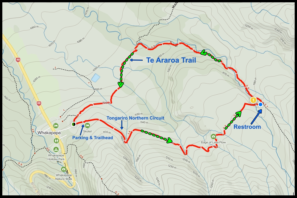
After reading about this park we are both so excited to see it. Today’s hike will be a 6 km hike through lava fields, forest and alpine scrublands. The area boasts three active volcanos and lots of different hiking options. We’ve chosen the Taranaki Falls hike…you know me, I’m a sucker for waterfalls.
The Road To Spectacular Tongariro National Park
The hour and half ride to Tongariro National Park is one of the more beautiful drives we’ve taken in New Zealand. The first fifty kilometers or so are on a two lane twisty turning road that skirts the fabulous and sparkly Lake Taupo. It’s a gorgeous sunny day with few clouds in the sky and the water on the lake is almost glowing as sparkles of sunlight dance on the surface. Looking down from the road we can see the water is amazingly clear…I’d say it’s as clear as a vodka martini minus the olive juice.
I want so much to stop and take photos at every turn but the drive is a long one and we want to get to the park early enough to enjoy a sunny hike. It’s pretty chilly out and as you know we are not cold weather animals.

Lake Taupo The Supervolcano
The largest freshwater lake in New Zealand, Lake Taupo was created after a super volcanic eruption occurred over 26,000 years ago. This eruption is known as the Oruanui eruption. 1800 years ago the Taupo eruption became the most violent the world has seen in over 5000 years. Its plume reached 50 km into the air and all of New Zealand was covered with ash. Areas near the site were buried in more than 100 meters of lava flow that spread 90 km from the vent. Some believe it is possible that the Taupo eruption was the cause of the red sunsets recorded by the Romans and Chinese in the day. Needless to say it was a pretty impressive eruption.
Supervolcanos are so explosive that they actually collapse upon themselves creating what is known as a rhyolite caldera. They are also known as inverse volcanos and their huge magma chambers are what make them so dangerous. The good news is they erupt less often than other volcanos. The bad news is if the magma field under the lake does have another supervolcanic eruption there are some 160,000 people who live within 100 km of the center.
The lake itself has a surface area of 616 square meters and a maximum depth of 186 meters. It’s stunning to look at and offered some great recreation activities. The lake is known worldwide as a trout fisherman’s paradise where brown and rainbow trout are abundant. And, if fishing is not your thing there is no shortage of lake tours, kayaking, jet skiing and more.
All of this is pretty impressive but for us it’s the views across this crystal clear lake that make it so spectacular. From Taupo you look across to Mount Ruapehu and it’s hard to imagine anything more beautiful.
Moving Along
Just outside of Tūrangi at the southern end of Lake Taupo we pick up Highway 47 which takes us through some stunning forest land before the road opens with expansive views across the scrublands to Mount Ngauruhoe and Mount Ruapehu both of which are also active volcanos. Today they are sporting radiant snow covered caps that shine like lighted beacons against the vibrant blue sky.
We speed along and I’ve got the window down which is forcing a brisk breeze through the car. The window is down because I’m snapping away for my New Zealand at 100 kph photos. I must be freezing Dan out because he finally decides it’s time to stop. He’s always so good about stopping to let me get great pics to share with you but I’m pretty sure today it has more to do with self preservation. I snap a few pics of Mount Ngauruhoe and then it’s back in the car where I promise not to put the window down again.

As we near the main entrance to the park we are greeted by a charming hotel that’s well known here. It’s called Chateau Tongariro and it exudes the ambiance and elegance of the Roaring 20s. It sets alone on a backdrop of striking volcanic mountains, brown and green scrubland and cobalt blue skies. If we’d only known about this place I’d have planned for us to stay the night. Oh well, we can’t see and do everything here so it’s off to get our hike on!
The Best Hike In New Zealand
Now we’ve been on same amazing hikes throughout this country. We’ve seen glaciers and beaches and mountains and lush green farmland but this, this is something so special it almost defies description. From the moment we begin on the trail we know it’s going to be simply incredible!
Before I go on let me put this out there for anyone who may want to come here to see this fabulous place in person. The Taranaki Falls trail is a 6 km loop so you can choose to start on the lower track or the upper one. I guess it depends upon your fitness level and desire to exercise but we chose the to start on the upper track. Why? Well, we’d read that starting there means you have less uphill climbs. That is always a bonus.
If you choose start on the lower track you can enjoy lots of uphill climbs including one area that has 100 steep steps. As for us we were very happy to take the upper track and deal with a bit less of a challenge.
Beginning on the upper track we follow a wide path that once was an old horse trail. The trail is flanked on both sides by Manuka and Red Tussock. Off to the right we see Mount Ruapehu with her shimmering white peaks shining brightly against the azure sky. In front of us is Mount Ngauruhoe which also boasts a layer of Mother Nature’s frozen white frosting and it is equally spectacular. The walk is relatively flat and the trail is in excellent condition with areas of boardwalk to make it even easier.
Before long the Manuka flanked path opens up and we are surrounded by low, brown, yellow and orange scrublands. The landscape around us opens to reveal breathtaking 360° view of the mountains as well as the valley below. At one point we stop and both stand in silence just taking in the magnificence that surrounds us.

Continuing down the track we see a series of eroded gullies that have been formed by wind, rain and frost. Soon after we are greeted by the Wairere stream. The flowing water captures my soul as it flows over, under and around the rocky stream bed. I’m mesmerized by each and every nuance, twist, turn and splash. I could stand here for hours taking photos and observing this natural wonder.
There’s a nice wooden bridge that crosses over the stream and just past that to the right is a small building sitting out here in the middle of nowhere. What is it? Well, it’s a head, or as you landlubbers call it, a toilet. Yep, they have actually put a toilet out here for the hikers. And it’s not just a “port-o-let”. It’s a nice, well maintained building. But, if you head this way be sure you bring along a little TP as it was clean out. Of course we never hike without a little “white gold” in our packs so we are all good.

After we pass the river and the toilet we walk the 100 steps DOWN toward the falls. They are pretty steep and not very even. With all of the forest surrounding me I start to get a bit of vertigo about halfway down so I have to stop and gather my senses. As I am standing here about three quarters of the way down I look up to the top and all I can think is, “Boy am I glad we took the upper track first!”

Once I finally make it down to the bottom I can hear the falls clamoring away. I don’t have to walk much further before the forest opens up and I can see the 20 meter falls tumbling over the edge of the 15,000 year old lava rocks. The varnish clear pool at the bottom of the falls seems small considering the amount of water that is crashing into it but it handles the flow with ease as it sends the water down river.

For the next little while the trail skirts the river and small gorge area. The forest here is filled with mountain beech trees, shiny broadleaf, umbrella ferns and toatoa. The deep greens and yellows pop out against the browns, grays and blacks of the lava rocks and it is all set up on the backdrop of a brilliant blue sky that’s dotted with cotton candy clouds. Seriously, could there be a better place in the world to be right now????
As we cross the river we’re now on the lower track which runs along the river and through a dense forest. The river is wider and more turbulent at the part of the track. The abundant vegetation provides cover from the sun and causes the temperature to drop several degrees. We both pick up the pace a little to keep warm.
You know what they say, “What goes up must come down” and well, when you start at the top of a track and walk down you eventually must go up to get back to the beginning. Fortunately for us the uphill part of this track is a bit more subtle than it would have been if we’d have gone the other direction. There are a few sets of stairs and some inclines but nothing I can’t handle.
It’s not long before we’re out of the forest and walking back through the scrublands where we get a few last 360° views of the mountains and the valley. Just about three hours from when we started we arrive back at the parking lot. We’re both feeling rather good about the great hike and the opportunity to view some of God’s most majestic scenery.
The Perfect Picnic Spot
Before leaving the park we take a drive up to the base of Mount Ruapehu. The ski lifts are running but there’s not much snow on the mountain. In fact there is none at the base! We take a look around and then Dan finds a spot to park overlooking the valley and the vast lava fields. We pull out our picnic lunches and enjoy some much needed nourishment while taking in the vistas.

We arrive back in Taupo in the late afternoon and find a nice little pub on the edge of the lake to stop at and have a beer or two. As we look out on the lake we see the weather beginning to blow across the mountains where we’d been hiking just a couple of hours earlier. Within minutes we can barely see their tops. Looks like we made it out just in time as a couple of locals tell us they will be closing the roads due to snow any time now. Well, at least we got to enjoy an outstanding day in one of New Zealand’s most brilliant parks before the bad weather came along. I guess it’s true, sometimes even a blind squirrel finds a nut.
Tomorrow we’re off to see the thermal pools at Orakei Korako Thermal Park.
Until next time,
Jilly & Dan
Read more about our trip to the Taupo area….Click Here


One thought on “Spectacular Tongariro National Park”